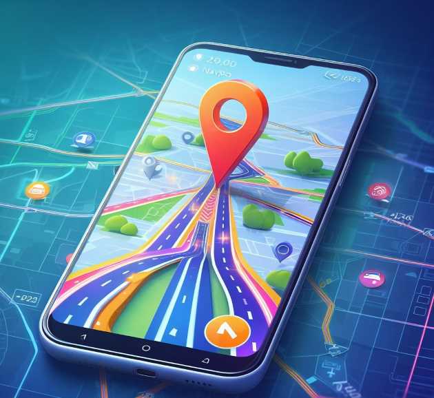
India is home to a powerful, home-grown satellite system called NavIC. NavIC map stands for Navigation with Indian Constellation. It works a lot like GPS, but NavIC is made just for India—and this makes it special.
Table of Contents
What is NavIC?
NavIC is India’s version of GPS (Global Positioning System). Instead of relying on satellites from other countries, NavIC map uses seven satellites launched by the Indian Space Research Organisation (ISRO). These satellites cover India and a region around it. This gives India more control over location services—especially in times of emergency or war.

Smart Cities powered by NavIC Map
A smart city uses technology to make everyday life easier. NavIC can help in many ways:
- Better Traffic Management
NavIC helps city planners track when and where traffic congestion happens. With this data, they can guide drivers through alternate routes and reduce traffic jams. - Public Transport Tracking
Buses and trains can share their real-time location. Riders can check a mobile app to know exactly when the next bus will arrive! - Utility Services
Think of sweeping vehicles, garbage trucks, or even power maintenance vehicles—they can follow precise daily routes using NavIC. - Emergency Services
If there’s a fire or an accident, emergency vehicles can reach the scene faster using NavIC’s accurate location information.
NavIC & Drones: A High-Flying Future
Drones have unlimited possibilities in India—from delivering medicines to mapping farmlands:
- Medicine & Vaccine Delivery
In remote villages, drones guided by NavIC can deliver vaccines or urgent medicine quickly where roads are poor or blocked. - Agriculture & Farming
NavIC makes precision farming easier. It helps drones spray pesticides or water exactly where it’s needed—saving time and money for farmers. - Forest & Wildlife Protection
Rangers can use NavIC-enabled drones to monitor forests or track wildlife without going deep inside the forest, making their job safer.
Smart Vehicle & Auto Tech
Future cars and buses can become smarter with NavIC:
- Self-Driving Cars
Building a self-driving car in India depends on accurate location data. NavIC provides the precision needed for safe navigation. - Ride Hailing & Logistics
Apps like Ola or Uber can improve their route maps and estimated time of arrivals if they include NavIC data.
Disaster Management & Relief Operations
- Earthquake & Flood Alert
NavIC satellites can adjust timing to help predict natural disasters. - Rescue Operations
Search and rescue teams can locate missing people faster using sensors and NavIC signals.
Why Your Phone Doesn’t Support NavIC Yet — And When It Will
You might be wondering: “If NavIC is so powerful, why isn’t it in my smartphone already?”
1. NavIC Needs Newer Chipsets
Smartphones need special chips called chipsets to receive satellite signals. These chipsets must understand NavIC’s signal format. Currently, many Indian and global phones don’t include this yet. Only a few models have started—the support is growing slowly.
2. Building New Hardware Takes Time
Phone makers like Qualcomm and MediaTek need to add NavIC support right from the design stage. This means spending millions on research and creating new prototypes. That’s not something done overnight.
3. Software and App
Even when the hardware supports NavIC, apps like Google Maps or Apple Maps must be updated to use it. It takes time for developers to add NavIC-compatible navigation, tracking, and emergency features.
4. Cost and Market Demand
Including NavIC chips costs more. Until there are enough customers demanding these phones, companies are cautious about spending on new hardware.
When Will NavIC Phones Become Common?
A few early-rate models are already shipping in India. Experts predict that over the next 2–3 years:
- Major phone brands (like Samsung, Xiaomi, Realme, OnePlus) will offer more NavIC-ready models.
- Bluetooth accessories (like fitness bands or trackers) will also begin to use NavIC.
- In 5 years, most mid-range and high-end phones sold in India will likely include NavIC as a standard feature.
Empowering Offline Navigation with NavIC
One of the coolest things about NavIC is it works without the internet. You don’t need 4G or Wi-Fi for it to show your location accurately.
Why Offline Navigation Matters
- Rural Areas: Many villages still don’t have good mobile networks. NavIC helps you find your way even in remote places.
- During Emergencies: If there’s a flood or earthquake, the internet may go down. But NavIC can still guide rescue teams effectively.
- Low-cost Handsets: Not all phones can afford constant mobile data. With NavIC and offline maps, people can navigate without paying for 4G.
How It Works
- Offline Maps + NavIC Chip: You store map files on your phone ahead of time. NavIC tells your phone where you are, and the map shows you the way—even with no data.
- Apps like Bhuvan (by ISRO) and UMANG could soon provide this—India-made apps using NavIC and offline mapping for safer, local navigation.
The Bigger Picture: Why NavIC Matters
1. Strategic Independence
Relying on foreign navigation means relying on other countries. NavIC gives India full control—an important thing in both peace time and emergencies.
2. Economic Boost
Local production, R&D investments, and the development of new apps and hardware will boost jobs and support India’s Atmanirbhar Bharat initiative.
3. Innovation in Next-Gen Tech
Whether it’s self-driving cars, drone delivery, smart farming, or disaster relief—NavIC makes them all possible with home-grown precision and engineering.
📊 Comparative Analysis: NavIC vs Galileo vs GLONASS
| Parameter | NavIC (India) | Galileo (European Union) | GLONASS (Russia) |
|---|---|---|---|
| Full Form | Navigation with Indian Constellation | Global Navigation Satellite System | Globalnaya Navigazionnaya Sputnikovaya Sistema |
| Operating Authority | Indian Space Research Organisation (ISRO) | European Space Agency (ESA) and European Union | Russian Federal Space Agency / Ministry of Defence |
| Operational Since | 2018 (regional operations) | 2020 (global operations) | 1995 (full operations) |
| Coverage Area | India and a 1,500 km radius around its borders | Global | Global |
| Number of Satellites | 7 operational | 24 operational + spares | 24 operational + spares |
| Accuracy (Civilian) | Approximately 5–10 meters | Up to 1 meter | 5–10 meters |
| Accuracy (Military) | Better than 5 meters | Sub-meter (PRS channel) | 2–5 meters |
| Signal Bands | L5 and S-band | E1, E5, E6 | L1, L2, L3 |
| Offline Capability | Yes | Yes | Yes |
| Smartphone Integration | Limited; growing with chipset support | Widely supported | Widely supported |
| Primary Application Focus | Regional strategic and civilian applications | High-precision civilian and regulated use | Military and civilian navigation |
| Special Feature | Designed specifically for Indian subcontinent needs | High precision and interoperability with GPS | Robust military-grade signal redundancy |

❓ Frequently Asked Questions (FAQs) About NavIC
1. What is NavIC?
NavIC, or Navigation with Indian Constellation, is a regional satellite navigation system developed and operated by the Indian Space Research Organisation (ISRO). It is designed to provide accurate position information primarily within India and up to 1,500 kilometers beyond its borders.
2. Is NavIC more accurate than GPS?
In specific regions, particularly within India, NavIC offers comparable or improved accuracy over the Global Positioning System (GPS), especially in urban and mountainous terrains where signal reflections can affect accuracy.
3. Why is NavIC not supported on most smartphones?
NavIC compatibility requires hardware support from the device’s chipset. As of now, only a limited number of mobile chipsets (e.g., by Qualcomm and MediaTek) provide NavIC support. However, adoption is expected to grow with governmental and industrial push for localization.
4. Can NavIC be used without internet connectivity?
Yes. Similar to GPS, NavIC is a satellite-based navigation system and does not require an active internet connection to determine the user’s location, provided the device has appropriate hardware support and preloaded maps.
5. What distinguishes NavIC from systems like Galileo and GLONASS?
NavIC map is region-specific and optimized for India and nearby areas. It employs the unique S-band along with L5, providing better signal penetration in densely populated or obstructed environments. Galileo and GLONASS, by contrast, are global systems.
6. Does Google Maps use NavIC?
Currently, Google Maps primarily relies on GPS. However, on devices equipped with NavIC-compatible hardware, Android’s location services may incorporate NavIC map signals to enhance accuracy within India.
7. How many satellites constitute the NavIC constellation?
The current configuration of NavIC consists of 7 operational satellites, forming a constellation suitable for regional coverage. ISRO has plans to expand this with additional second-generation satellites.
8. What role does NavIC play in disaster management?
NavIC is integrated with early warning systems for natural disasters such as floods and cyclones. It also assists in post-disaster rescue operations through accurate positioning, even in areas with damaged mobile or internet infrastructure.
9. Will NavIC evolve into a global navigation system?
As of now, NavIC is classified as a regional navigation system. However, ISRO has expressed intentions to extend its reach and upgrade its infrastructure for broader coverage in the future.
Final Thoughts
NavIC is not just another satellite system—it’s India’s leap forward in navigation tech. It will help build smarter cities, empower farmers, improve emergency response, and propel cutting-edge tech like drones and self-driving vehicles. Although your phone might not support NavIC right now, it will soon—and when it does, it will change how we move around and innovate.
Share this blog if you believe in India’s tech future! And let me know if you want help writing follow-up posts for your readers.


